MTNTOUGH - Use promo code RANDY for 30 days free

Maps - Hardcopy

ginkgo72

Member
Joined
Dec 19, 2010
Messages
162
Location
Minnesota
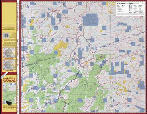
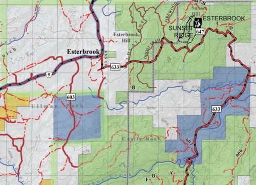
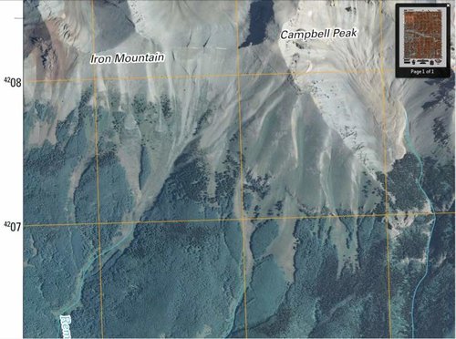
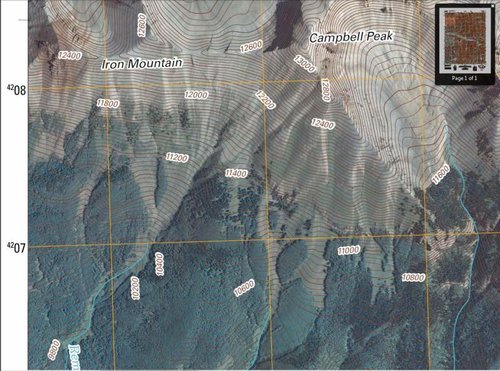
What is the "best" hunting map out there? I've used MyTopo but I'd love to get something that shows more of a 3D type image...I'm looking at spending a decent amount of money to get some quality. (I've already got a great GPS)

thanks!
 
diyhuntingmaps.com for wyoming has caught my eye.

I am partial to the DeLorme Topo computer software,make my own notes and markings and Print my own maps also

Some of the DIYHM images attached
 

Attachments

  • diyunit7.jpg
    diyunit7.jpg
    76.7 KB · Views: 521
  • diyunit7 detail.jpg
    diyunit7 detail.jpg
    71.6 KB · Views: 450
You can download pdf's for free or order hard copies of the new US Topo from the USGS map store online.

The downside is that you'll have to copy over public land boundaries from your BLM maps.
 

Attachments

  • Capture1.jpg
    Capture1.jpg
    69.7 KB · Views: 452
  • Capture2.jpg
    Capture2.jpg
    86.4 KB · Views: 459
Very cool. Thank you. With all the fires and beetle killed trees out there. I'm hoping to get as current photo maps as I'm able as well.

How about water sources - any maps that have that type of indicator?
 
I have used National Geographic Trails Illustrated maps in the past and like them. Unfortunately you are limited to whatever maps they have available and can't make a custom one in the same format. They do not show public/private, but the roads and trails are more clearly labeled than on other maps I've seen.
 
If Arizona is on your list, look in to "Flat Line maps".
A very good, detailed map with tons of useful information.
 
Keep this thread going. Maps are a huge part of our success and I've learned a couple things here already. Google Earth and AcmeMapper are our current favorites and soon we'll add in the Hunting GPS Maps with land ownership.
 
Link to USGS maps

Hard to beat USGS topo maps. They can be downloaded free (your tax money paid for them). The newest versions have high quality color aerial photo + contours - and are available for much of USA...the older version without aerial are available for all of USA. Go to the below link, click 'map locator' to find your spot and then download.
http://store.usgs.gov/b2c_usgs/b2c/start/(layout=0_1_75&xcm=r3standardpitrex_prd&uiarea=1)/.do

USGS downloads are pdf files by default - viewable with adobe reader (free also). If you have Acrobat then you do mark ups right over the map; if no Acrobat then save as jpg file and use whatever software you have such as MS Pictures for cropping, marking, etc. ...or just print them out and write on them. If you need a large sheet, go to Staples, Kinko, etc. and for a few dollars you can walk out with a color map under your arm.
Another option that I used extensively last summer on vacation out west was the 'maps' app that came free on my iphone. Traveled through Montana, Idaho, Wyoming and S. Dakota and had cell service (Verizon) almost everywhere...was able to find some good dirt road drives in remote areas and track exactly where I was the entire time.
 
Last edited:
Caribou Gear

Latest posts

Forum statistics

Threads
111,254
Messages
1,952,544
Members
35,099
Latest member
T_allen7
Back
Top