Ollin Magnetic Digiscoping System

Bitterroot Goats

tjones

Well-known member
Joined
Jun 9, 2009
Messages
4,665

Ravalli County Fish & Wildlife Association

9h ·
RCFWA ‘ADOPT THE BITTERROOT GOATS’ INITIATIVE 2024
In addition to our other projects dedicated to conserving wildlife & public access in the Bitterroot, RCFWA has a long history of supporting mountain goat management in the Bitterroot Range.
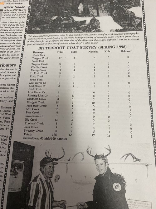
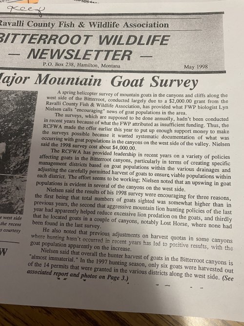
Because of the steep terrain in the Bitterroot drainages, getting an accurate count with eyeballs in a helicopter or hiking in from the trails is tricky. These projects are expensive, and funding is always a challenge. The last complete survey of Bitterroot drainages was done in 2015, almost 10 years ago. FWP biologists have conducted sporadic and scaled down goat surveys since 2015.
RCFWA members are excited to sponsor a new somewhat experimental method - Aerial Infrared camera technology from a fixed winged aircraft operated by Owyhee Aerial Wildlife Research out of Idaho. Using thermal signatures has been used effectively on a wide range of other species. Hopefully this technique will give us a new and safer way to count goats.
To find out more about infrared technology & see actual video of how it works, visit: https://www.owyheeair.com/air-wildlife-surveys/
We've committed $8,000 toward this survey effort for spring 2024, working closely with MPG Ranch and MFWP. The survey will include 3 adjacent drainages in the Bitterroot Range. This initial survey will consume much of the allotted $8,000. If this technique proves effective, we will use the balance of our contribution, along with new donations as seed money to help fund a survey of the entire Bitterroot range.
Your support is vital to meet our goals and is greatly appreciated. We want to keep effective, consistent goat surveys funded going forward whether using new technologies or previous methods.
More information on past surveys and the new technology will be available at our upcoming Auction to Benefit Wildlife on February 24, 2024, at the Ravalli County Fairgrounds event center.
Tickets are $60 each and must be purchased in advance. Tickets are available at the Bitterroot Trading Post in Hamilton, Victor Liquor in Victor, or call Fred at 406-369-1150 or Linda 406-381-9641
 
Being that I just spent the last two days listening to presentations about the growing use of drone technology in meteorological and atmospheric research, this seems like an ideal opportunity for the ever-growing world IR-equipped drones -- probably much cheaper too.
 
I just hope it works. I notice that company doesn't include mountain goats on their website. I heard goats' coats are so insulating they don't show up on IR.
 
I think drones have a place in these efforts and will likely become more prevalent but flight ranges and times currently limit effectiveness. To survey a basin 10 miles deep you'll need to hike the drone most of the way there.
Now if some of the military ones could be used...
 
I was wondering when drone surveys would become a thing. It seems like they would be more effective than visual surveys.
WDFW uses them for a lot of surveys these days
From ducks and geese:
to turkeys and pheasants
to salmon
To pigmy rabbits
to moose
 
Looks like they're using a wescam MX-10 gimbal. SWIR, EO and a LRF capabiliteis. These things aren't cheap like multiple 100K's at a minimum but for the size of aircraft they’re using it's probably appropriately sized gimbal to get the image stabilization needed. It's an interesting application of the technology, but I agree that a smaller gimbal with EO/IR capabilities mounted on a drone with a pre-determined flight path and video recording could be a cheaper alternative.

Here is wescams video on the camera system:

 
Last edited:
WDFW uses them for a lot of surveys these days
From ducks and geese:
to turkeys and pheasants
to salmon
To pigmy rabbits
to moose
I remember looking at this a few years ago, and read a couple studies done in the Midwest somewhere. They compared visual surveys to thermal drone surveys for deer. The visual surveys weren't far off with their corrections if I remember right.
 
I have flown a couple of goat surveys with FWP back in the mid 2000’s. We flew in a Bell.

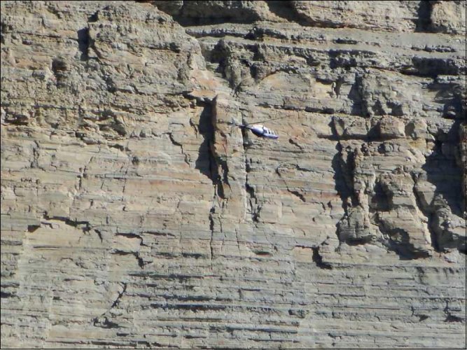
Great fun but anyone familiar with the Bitterroot’s know how big and vertical the north side of those canyons are.

It’s very time consuming, which makes it expensive and flying along those canyon walls, a bit dangerous.

Thermals along the walls make it a bit like a really bad fair ride. But a great way to see the canyons.
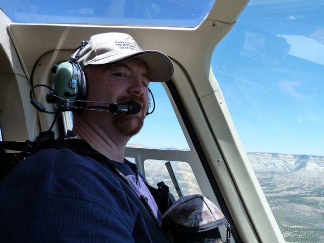
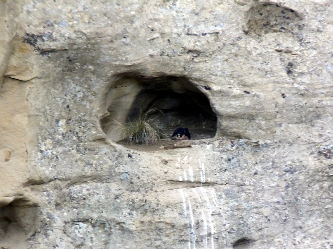
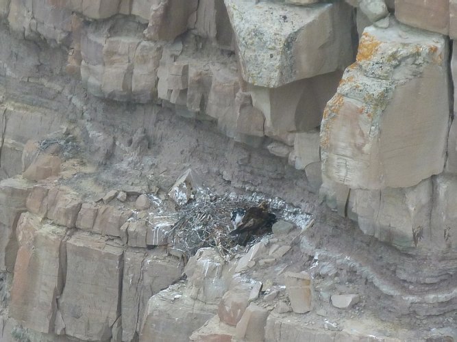
I used to do cliff surveys for raptor nests from a helicopter. Equally sketchy. The pilot I was with in all of these photos was killed in a crash 3 years later.

Photo1.jpg

053111(5).jpg

PEFA-1.jpg

GOEA-1.jpg

052711(3).jpg
 
Last edited:
So here is a bit of a follow up from Owyhee Air. They were able to fly on March 22nd and covered the targeted canyons.

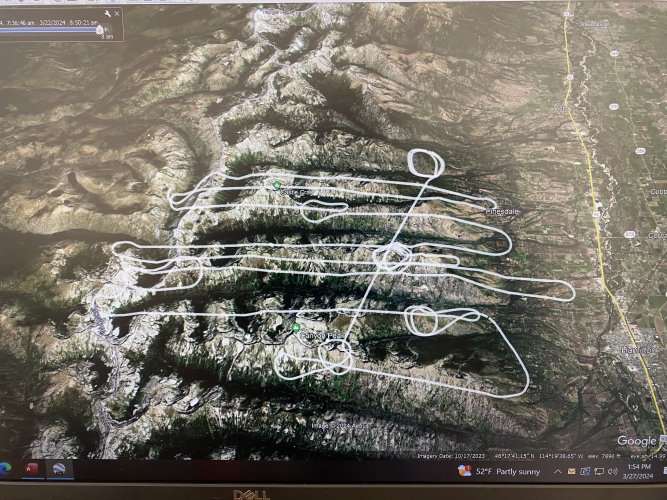
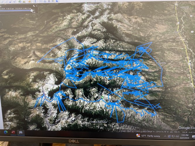
Here is a highlight from an email we received and a couple of KML screen shots off of Google Earth.

The white track on the first pic is the path of the plane. The blue track is where the camera looked during the flight. A solid effort but disappointing results. We are looking at trying it again in the summer after the goats shed a bit and Owyhee makes some equipment changes. Owyee did give us a big break on the flight costs due to flying only 1 day not 2 and also coming up empty.

Thanks to HT's that pitched in with donations. Much appreciated.


From Owyhee Air:

After being weathered out on Thursday, the crew was able to make a solid run on all four drainages that were outlined in the test area, on Friday. Unfortunately, the effort was not successful, and the goats remain elusive. Mountain goats are extremely challenging to survey, regardless of the approach used, and it looks like the search for a good IR protocol must still continue. Our operator thinks that a different sensor might yield results on the goats, but that sensor is currently deployed in Canada and won't be back for a while. I talked with the operator of that sensor who seems to think that he can find goats with it during the summer. So, right now our plan is to try again this summer when we return to the area for some summer work around Flathead Lake.

The two attached KML files show the flight track of the aircraft on this effort, and the "Camera Breadcrumb" shows everywhere the camera looked during the flight. Unfortunately, this is all we have to show this time around.


Goat IR1.jpgGoat IR.jpg
 
No goats? At all? So they're saying they saw goats but the sensors didn't pick them up? Or that it's possible there were actually no goats?
 
The IR camera picked up no goats. They are high enough they can’t see the goats. That unit is usually surveyed by helicopter. Given the terrain the helicopter survey is dangerous and goats are difficult to find.
 

Forum statistics

Threads
111,145
Messages
1,948,678
Members
35,048
Latest member
Elkslayer38
Back
Top