Base camp and google earth

Short answer is if you want sattelite imagery to transfer to your GPS you will have to get a subscription to Bird's Eye via Garmin. I think $29/year. Then you can select what areas to download and transfer to GPS.
 
If you're wanting to export your tracks and waypoints from Google Earth, instead of imagery, try this.

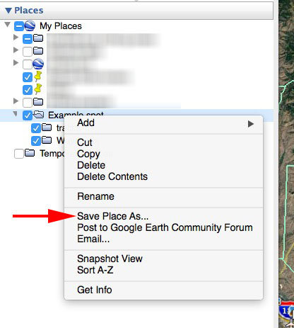
Find the item you want to export in the left column of Google Earth, right-click it, and you should see Save Place As... in the menu. From there you can create a KML file that BaseCamp can open and display.
exportfromge.jpg
 
^^^ this, for tracks/waypoints.

If you want various map types including MyTopo and Sat imagery use TopoFusion.
 
Thanks Paul, so far so good but do see how i can open that document in Base camp. Got it . Thanks again.
 
You're welcome. I use a Mac, so my menu might be a bit different than what you see, but hopefully this will get you on the right track. There are two steps.

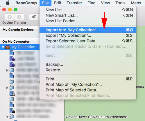
  1. In the left column of BaseCamp, decide which folder you want to bring the Google Earth info into. I chose the default "My Collection" for this. Click it to select it.
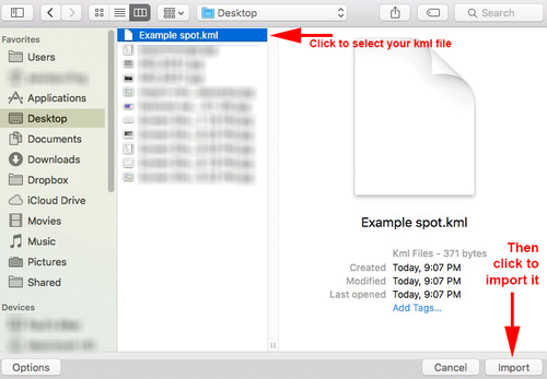
  2. Go to the File menu, click "Import into (your folder name)" and navigate to where you saved the KML file from Google Earth. Once you locate it, click the Import button.


import-into-basecamp.jpg
import-to-bc.png
 
Last edited:
Caribou Gear

Latest posts

Forum statistics

Threads
111,292
Messages
1,953,700
Members
35,113
Latest member
1sockeye2
Back
Top