wingman1
New member
Its time to fly Brett French in with the gazette


Follow along with the video below to see how to install our site as a web app on your home screen.
Note: This feature may not be available in some browsers.

That's what onXmaps is- data from cadastral symbolized for display on the GPS unit. Could be inherent error of the unit or error in the base map that's produced from that cadastral data. Or both.How about Montana cadastral?
It is starting to make sense to me. The GPS is accurate at finding your location, but the map data that shows land ownership could be off. I wonder if you can get coordinates of the corners at the courthouse.Looks very fishy to me. GPS are wrong?
I have aerial overlays that match up with hunting maps chip. What a cover up by BLM.
Your overlays probably use the same source as the gps maps do, so they'd reflect the same. IF the Wilks did get it surveyed, then that should be confirmed by the BLM. That "indicates that it likely was" in the article is BS.
If the Wilks are up to no good then I hope they get their asses handed to them, but I'm telling you from personal experience, that GIS boundary can't be trusted that accurately, it needs to be surveyed.
I wonder if you can get coordinates of the corners at the courthouse.
As a Land Surveyor I can say Randy has this right. The day all GIS data is accurate on hand helds will be the day I no longer have a job...an exaggeration yet some truth. I have documented our hand helds being as far off as 100-something feet from a found section corner when comparing with 25000 dollar surveying gps equipment.

Yep and there are folks here who cautioned against relying on GPS for that purpose.Yikes fowladdict I don't want to think about that in light of corner crossing threads.
And that's assuming they are both projected in the same datum. Lots of small errors can add up to lots...That's what onXmaps is- data from cadastral symbolized for display on the GPS unit. Could be inherent error of the unit or error in the base map that's produced from that cadastral data. Or both.
FWIW, if I'm looking at the picture correctly the margin of error calculated by your GPS (the blue circle) shows that the trees photo'd may not be on BLM. Just offered as a heads up on the limits of commercial grade handheld GPSs. Not condoning the actions in the least.
Interesting. According to Wingmans GPS the fence was almost 100 yards off from the boundary the GPS showed. Fowladdict said he has seen up to 100 feet off on his comparisons so 30 yards is his worst case vs. the 100 yards wingman saw. Ton's of surveyors and real estate agents use the map on a GPS all the time to find property pins and boundaries and we have never heard any concerns with accuracy over what Garmin GPS units claim which is 10-20 feet.
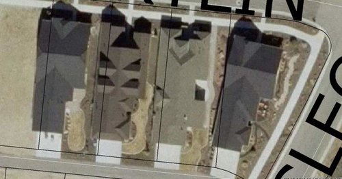
I don't think recreational GPS units are that far off. If so I should be living 3 houses down in my neighborhood. A 100 yards off would put me 3 lots over!
Matt
Interesting. According to Wingmans GPS the fence was almost 100 yards off from the boundary the GPS showed. Fowladdict said he has seen up to 100 feet off on his comparisons so 30 yards is his worst case vs. the 100 yards wingman saw. Ton's of surveyors and real estate agents use the map on a GPS all the time to find property pins and boundaries and we have never heard any concerns with accuracy over what Garmin GPS units claim which is 10-20 feet.
I don't think recreational GPS units are that far off. If so I should be living 3 houses down in my neighborhood. A 100 yards off would put me 3 lots over!
Matt