Hunt Talk Radio - Look for it on your favorite Podcast platform

Idaho Middle Fork

Jherrera

New member
Joined
Aug 14, 2016
Messages
8
Location
Stockton, CA
A buddy and myself got OTC tags, one elk and one deer. We are hiking-in September 30th and coming back October 9th. He has a 7 mag and I have a 270. Last year we hiked in California, we were able to move about 7+ miles a day with our packs, estimating a 600ft elevation climb, so we are in pretty good shape. We live in California and this will be our first time trying Idaho so we are looking for an experienced/familiar Idaho Hunter. We are both drawn for Middle Fork, units 20A, 26 & 27.
Thanks, Joe.
 
Good luck! The Middle Fork is some of the most amazing country I've ever been in. Steep is an understatement, but neat country. I was helping a pard on a sheep hunt, but we did see a few deer and heard some elk bugling.
 
I hunted in Unit 26 back in 2007, which was a big fire year. A lot of the area looked like the surface of the moon, but it should be grown up pretty well by this time. As 1_Pointer noted, steep is the word. Also wolf country. Spectacular country.

Good luck.
 
Last edited:
Why not fly to an airstrip and hunt from there? The majority of the animals I've seen in 27 are within a few miles of the MF.
 
I've looked into and plan to do a hunt similar to this in the next few years. Why not fly in? Its relatively inexpensive. I have emailed back and forth with an air service out of McCall. Sounds like the way to go.
 
I just called middle fork aviation to inquire and you're right, it's relatively inexpensive. We are looking into all options. Do you have any ideas where you may fly into? We aren't going with any outfitters so we are going to rough it and hope we come across some good game
 
If you are estimating your max range to be 7 miles a day or 600' elevation, you're pretty much guaranteed a 350" bull and a 190" muley :).

There are large area's void of big game, and dense pockets of rutty elk that don't get much pressure.

Have fun and soak it in.
 
Our overall altitude climb last year was close to 1500 vertical feet so we aren't too scared of the climb
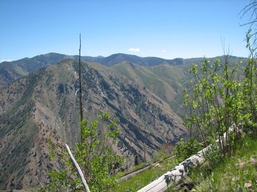
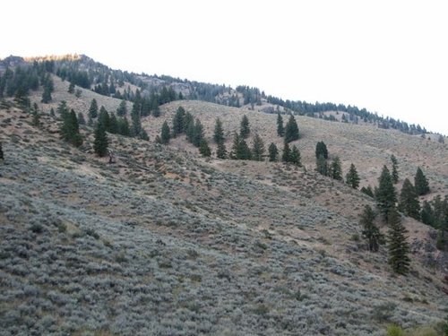
Here's what some of that country looks like!


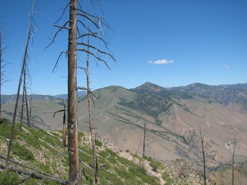
Here's a different part of the country. We started at the river which is behind me and out of site. IIRC according to my GPS we were a touch over 1400' higher than the river but less than 1/2 mi from the river...
 
Here's what some of that country looks like!


Here's a different part of the country. We started at the river which is behind me and out of site. IIRC according to my GPS we were a touch over 1400' higher than the river but less than 1/2 mi from the river...


That looks beautiful. It does look like a pretty tiring climb, but we're young so I think we can swing it. if you're willing to point me in the direction of a good area to hunt i would be gravely appreciative ;)
 
Last edited:
Not sure of the unit boundaries, but I would fly into cold meadows before any strip along the middle fork if I was absolutely forced to hunt elk in any of that country.

IME, it seemed to me like most of the game was on the upper 1/3 of the country along the middle fork. I don't care where you leave the middle fork from, its a hellish climb. If I had to hunt elk from the middle fork...I'd take up golf. I don't enjoy hunting elk enough to put myself through that. Deer, possibly, if you only shot big ones and hunted with a buddy. In the unfortunate event that you found a big one, you could split the load and not ever have to go back.

I've had to work in there...nothing nice about it, except when its over.

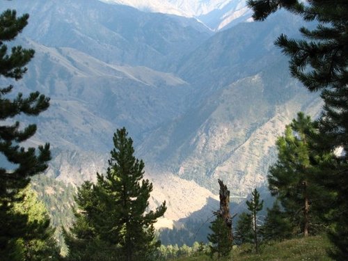
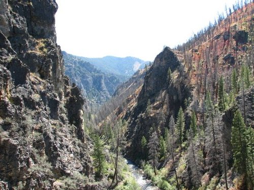
A few more pictures...be sure to eat your Wheaties.

West Fork Little Loon:

168.JPG

Mahoney and Norton peak from little loon:

173.JPG

Loon Creek:

168.JPG

Cottonwood peak, looking toward confluence of the Middle Fork near Stoddard.

cottonwood%20peak.JPG


Looking back form Dead Horse toward the confluence and Corn Creek. We gained just shy of 5K feet in elevation this day...on horses and it still sucked. On the way down a couple days later, had a horse wreck, one more roll and we would have killed 2 horses.

IMG_2963.JPG

Marble Creek:

IMG_2590.JPG

Pungo Mountain from Mitchell Ranch:

IMG_2602.JPG
 
Buzz,

We had a horse wreck on the Stoddard Cr trail. Like you, we were damned close to killing a horse.

Great country, but not for the faint of heart. Watch out for rattlesnakes.
 
If you decide to do a flight, Middle Fork Aviation is the only place I would fly with. I've flown into Banard, Thomas Creek, Mahoney, and Cold meadows with them...every pilot was awesome. I also talked and flew with the owner, and he showed me the scheduled maintenance and daily check list on their planes. Very exhaustive, and above and beyond what the agency I work for requires. They take it seriously and are extremely safe.
 
Buzz,

We had a horse wreck on the Stoddard Cr trail. Like you, we were damned close to killing a horse.

Great country, but not for the faint of heart. Watch out for rattlesnakes.

I don't doubt that...Stoddard is a monster. It's not a question of "if" in that country, only when and how bad...

Yes, the middle fork is full of rattlesnakes, little loon was loaded with them.

I flat admit it...that country is tougher than I am.
 
Last edited:
For a fly-in hunt, I'd pick one of the southern strips - Indian, Thomas, Mahoney or Lower Loon. Elk and deer are killed at each strip. I've killed and saw elk around Thomas. However, an outfitter is at the Middke Fork Lodge near the strip. I've been to Mahoney and talked to hunters who killed elk (saw the racks).

I hunted 26 (Big Creek) 15 days in 2012 and never saw an elk. Plenty of deer, though.

I've seen elk on top of ridge lines and along the river. I always saw more deer as it got closer to November. A snow storm in October will push the deer to the winter range along the river.

I've always flown with Cascade Aviation. They have the mail route for the MF and know the country well.
 
Back
Top